
Documentation for Trees on Your Property
Tree Surveys in Dallas for property planning, construction projects, and preservation decisions that require detailed tree information
North Texas development and construction activity often require documentation of existing trees before site work begins. Advanced Tree & Shrub Care, Inc conducts tree surveys that identify species, measure size, assess condition, and assign tag numbers to individual trees across residential and commercial properties in Dallas and surrounding communities. Developers, architects, and property owners use this information when planning projects that must account for existing vegetation, evaluate preservation options, or calculate mitigation requirements under local tree ordinances. You receive a structured record that connects each tree to its location, dimensions, and condition at the time of survey.
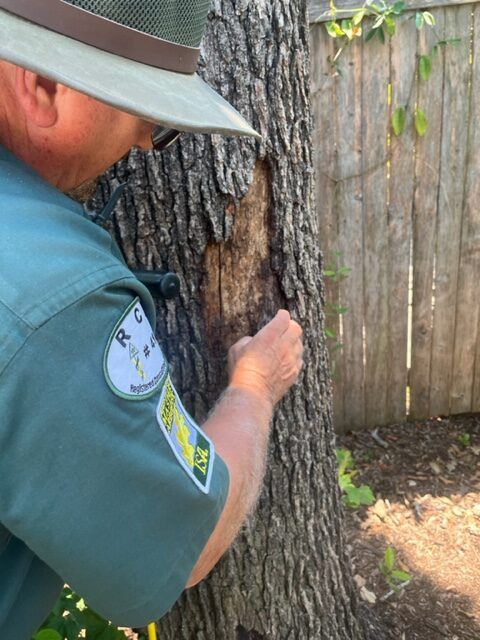
The survey process involves walking the property, tagging each tree with a numbered marker, and recording species, trunk diameter, approximate location, and visible condition observations. Data is compiled into a format that project teams and municipal reviewers can reference during permit review and construction planning.
Schedule a survey consultation to discuss the property scope and the level of detail needed for your project.
How Tree Surveys Address Planning Requirements
Each tree is measured at a standard height above ground to determine its size classification, which may affect whether removal permits are required or whether preservation carries mitigation value. Species identification matters because certain native or heritage trees are prioritized under municipal codes, and condition assessment helps distinguish healthy specimens from trees that are already compromised by disease, decay, or structural defects. Tag numbers create a reference system so that plans, permits, and construction documents can specify which trees are being preserved, removed, or relocated.
Once the survey is complete, you have a documented baseline that shows what was present before construction started. This record supports permit applications, informs site design decisions, and provides verification if questions arise during inspections or after project completion about which trees were affected.
Surveys document tree size, species, condition, approximate location, and tag numbers, but they do not provide legal property boundaries, engineering-grade GPS coordinates, or regulatory approval. Site-specific requirements vary across municipalities, and some jurisdictions require licensed surveyors to certify tree locations for formal permitting processes.
Answers to Frequent Service Questions
Property owners and project teams typically ask about scope, accuracy, and how survey data connects to local regulations before scheduling documentation work.
What information does a tree survey include?
The survey records tree species, trunk diameter measured at a standard height, visible condition observations, approximate location on the property, and a corresponding tag number attached to each tree. This data helps project teams identify individual trees and plan around existing vegetation.
Why would I need a tree survey before construction?
Many North Texas municipalities require documentation of existing trees before issuing permits for construction or significant site work. Surveys provide the baseline information needed to evaluate preservation options, calculate mitigation credits, and demonstrate compliance with local tree ordinances.
How are tree locations determined during the survey?
Locations are approximated based on measurements from property features, structures, or lot lines. If engineering-grade accuracy is required for permit approval, a licensed land surveyor may need to certify tree positions using GPS or total station equipment.
What does tree condition assessment involve?
Condition observations note visible signs of health or decline, such as dead branches, trunk decay, leaning, root damage, or pest activity. These observations help distinguish trees that are suitable for preservation from those that are already compromised and may not survive construction impacts.
Can a tree survey help with mitigation requirements?
Surveys document tree size and species, which are used to calculate credits or debits under municipal mitigation formulas. Advanced Tree & Shrub Care, Inc includes applicable credit information in survey reports, but regulatory approval depends on how local codes apply to your specific project and site conditions.
Advanced Tree & Shrub Care, Inc provides tree survey services for properties across Dallas, Plano, Frisco, McKinney, and the broader North Texas region. Discuss the property, project scope, and documentation requirements to determine what level of survey detail is appropriate for your situation.